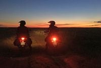
Riding across the USA is no big deal, right? Well, how about doing it on mostly dirt roads? Yes, it’s been done before and we know three riders who are about to do it again. Dave Bramsen and his sons, Paul and Caleb, have packed three Hondas to travel across America by way of the TransAmerica Trail. The TAT is 5,200 miles of country dirt roads and trails connecting Cape Hatteras, North Carolina, on the East Coast to Port Orford, Oregon, on the West Coast. Is this the ultimate way to see America? Follow along via Dave Bramsen's blog and see.
In our single days, when my buddy Bret and I rode our Honda CB750 and BMW R90/6 from Santa Barbara, CA, to South Carolina, if we used hand signals whenever we wanted to pull over for a break. Now we communicate by Sena helmet intercoms. Technology has forever altered relationship to our machines.
Back then, map-shopping was one of the pleasures of planning a scenic backcountry road trip. I still think paper maps are superior for seeing route details (that don’t vanish when your head zooms back), and they certainly do a better job at connecting rider to the route than a GPS does.
But getting back to 2017, my sons and I crossed over 7,000 miles of America, 5,200 of which were a virtual trail of breadcrumbs via Garmin GPS. Thousands of dirt miles include GPS paths through countless sage bushes that extended to the horizon. That is something that a paper map might not provide. Neither map nor GPS will warn you of surprises that appear after miles of muddy road lie behind you, such as the one we encountered on this leg of the trip along a muddy road in Arkansas. After watching the video you’ll see that we found a workaround.
Though a demon GPS could take you off to the Darien Gap while your intent is Oregon, you’ve got to trust your technology. And have a map for reference!
Below is a summary of the two primary TransAmerica Trail GPS and map vendors:
There's a bit of a rivalry going on between the two TransAmerica Trail GPS vendors. Sam Correro is the original guy at transamtrail.com. He sells a set of maps for about $300. GPS cards of each state are $12 or 9 for $108. His site is basic and straightforward. His competitor is gpsKevin at gpskevinadventurerides.com. Sam's route starts near the NC/TN border and he calls his the "exclusive" source. Kevin's site declares, "If the route does not go coast to coast it is not really TransAmerica." Sam warns of being misled by Kevin onto private lands. Either way, both vendors offer a useful product. Check them out.


/cloudfront-us-east-1.images.arcpublishing.com/octane/BFNTCTLDSTYLBXTI7LXVZJYRCQ.jpg)


/cloudfront-us-east-1.images.arcpublishing.com/octane/QCZEPHQAMRHZPLHTDJBIJVWL3M.jpg)
/cloudfront-us-east-1.images.arcpublishing.com/octane/HXOUJXQWA5HBHGRO3EMJIGFMVI.jpg)

/cloudfront-us-east-1.images.arcpublishing.com/octane/3TIWWRV4JBBOLDVGRYECVVTA7Y.jpg)
/cloudfront-us-east-1.images.arcpublishing.com/octane/KIX5O23D5NAIBGFXBN3327DKZU.jpg)
/cloudfront-us-east-1.images.arcpublishing.com/octane/7GJYDUIPXRGMTMQKN6ONYOLBOU.jpg)
/cloudfront-us-east-1.images.arcpublishing.com/octane/MUQLOVLL2ZDGFH25ILABNBXKTI.jpg)
/cloudfront-us-east-1.images.arcpublishing.com/octane/TNOU5DNE2BC57MFPMGN2EIDXAM.jpg)
/cloudfront-us-east-1.images.arcpublishing.com/octane/GTCXACQGJ5HAPDTGWUQKDEH44E.jpg)
/cloudfront-us-east-1.images.arcpublishing.com/octane/S35YGSEMEZB4BLTDJTSZPF4GLA.jpg)
/cloudfront-us-east-1.images.arcpublishing.com/octane/5UOT6HPX2JFMRJAX6EH45AR4MQ.jpg)
/cloudfront-us-east-1.images.arcpublishing.com/octane/OKWOJWAKP5EP3OACCRRWPCIX2Q.jpg)
/cloudfront-us-east-1.images.arcpublishing.com/octane/2WF3SCE3NFBQXLDNJM7KMXA45E.jpg)
/cloudfront-us-east-1.images.arcpublishing.com/octane/G4MG6OUCJNBSHIS2MVVOTPX65E.jpg)
/cloudfront-us-east-1.images.arcpublishing.com/octane/IIGGWFOTOJGB7DB6DGBXCCMTDY.jpg)
/cloudfront-us-east-1.images.arcpublishing.com/octane/QSTCM6AVEZA5JJBUXNIQ3DSOF4.jpg)
/cloudfront-us-east-1.images.arcpublishing.com/octane/U4I7G625B5DMLF2DVIJDFZVV6M.jpg)
/cloudfront-us-east-1.images.arcpublishing.com/octane/B6XD6LS6IVCQPIU6HXDJSM3FHY.jpg)
/cloudfront-us-east-1.images.arcpublishing.com/octane/ICL63FEDDRDTTMINYICCEYGMDA.jpg)
/cloudfront-us-east-1.images.arcpublishing.com/octane/FCGZHQXRBZFLBAPC5SDIQLVF4I.jpg)
/cloudfront-us-east-1.images.arcpublishing.com/octane/WNOB6LDOIFFHJKPSVIWDYUGOPM.jpg)

/cloudfront-us-east-1.images.arcpublishing.com/octane/X33NU3E525ECRHXLNUJN2FTRKI.jpg)
/cloudfront-us-east-1.images.arcpublishing.com/octane/6KKT5NNL2JAVBOXMZYS5ZO76YA.jpg)